
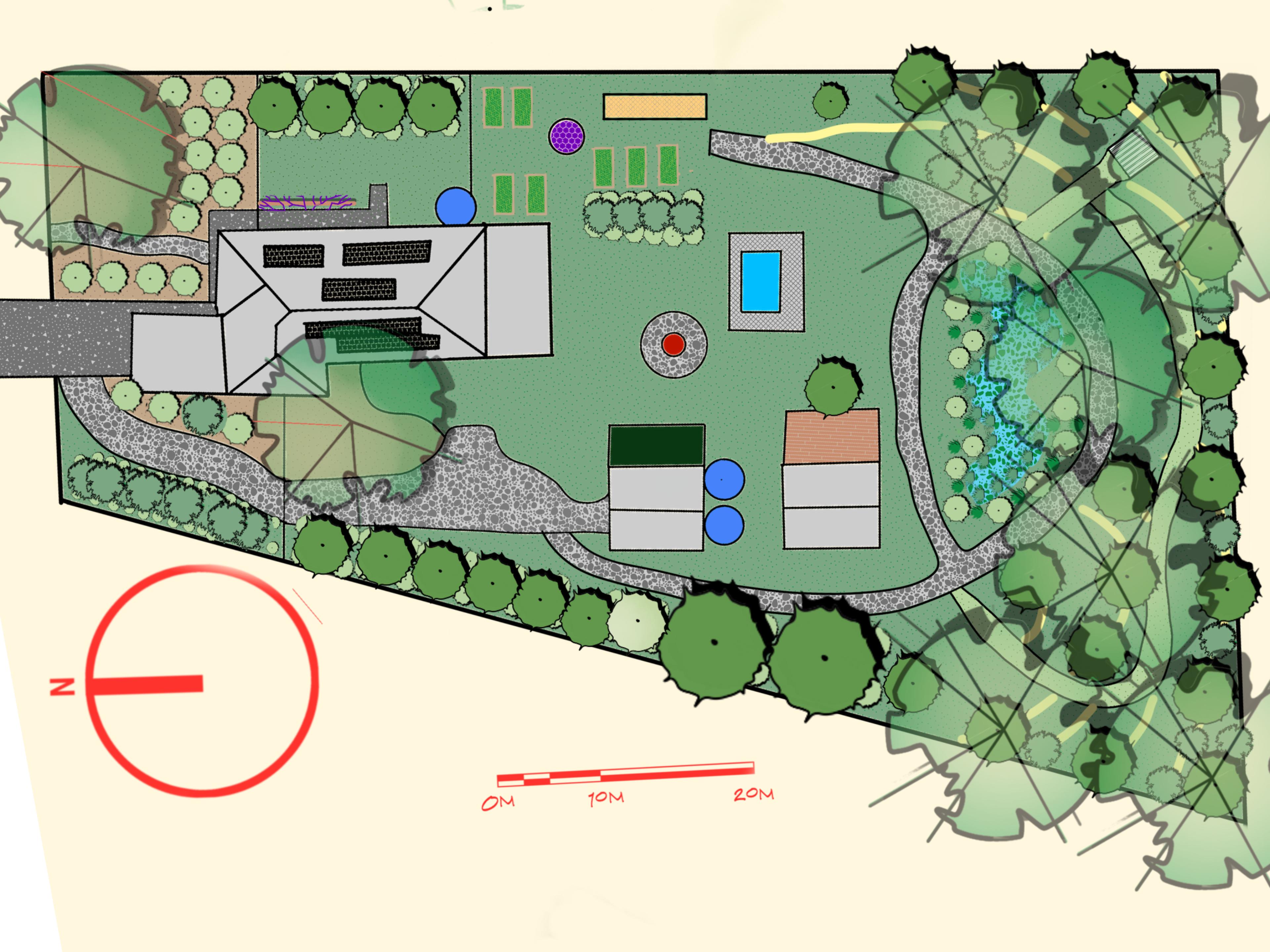
Most of what I write here pulls one idea out of the library and explains it on its own. This one's different. It's a single real design, Jake's acreage out at Kensington Grove in the Lockyer Valley, walked through from the first visit to the finished plan, including the part where I got something wrong and caught it before it went out the door.
The site visit
Jake's place wasn't a blank block. There was already a working kitchen garden, established fruit trees, and a fire pit he was clear he didn't want to lose. That changes the whole job. I'm not designing onto empty ground, I'm working out what to build around what's already earning its place, and what to leave alone entirely.
A couple of hours on the ground, walking the boundary, standing where the sun actually falls at different times of day, watching where the slope wants water to go. None of that shows up as a single dramatic finding. It's a lot of small, unremarkable observations that only add up to something once they're all on the same map.
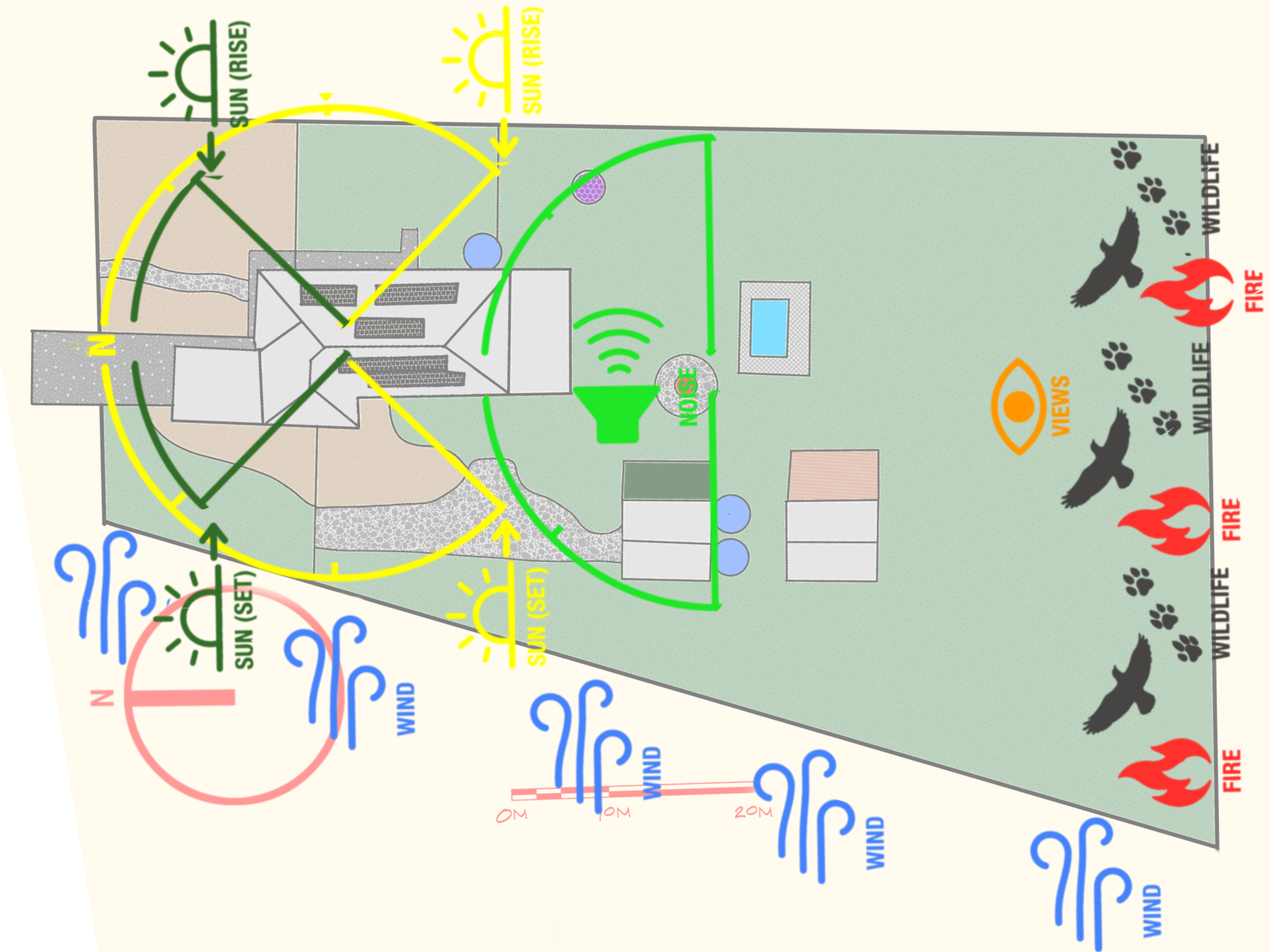
That map is the sector analysis. Every external force acting on the property, sun across the seasons, prevailing wind, fire risk from the boundary, wildlife movement, noise, views worth keeping, all drawn onto one sheet so the design can work with them instead of ignoring them.
What the soil actually said
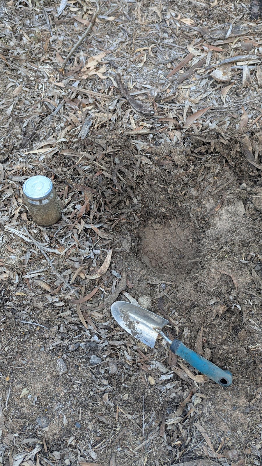
One finding wasn't small at all. I ran three separate jar tests across different parts of the property, and dug a small hole each time to have a proper look while I was at it. All three came back close to pure sand. I didn't find a single earthworm in any of them.
That's the kind of result that reorders a whole design before a single plant gets chosen. It meant soil couldn't be something I dealt with in the corner that looked worst. It had to come first, property-wide, before anything else was worth putting in the ground. I've written before about what a jar test actually tells you and why sand behaves the way it does. This was the property that article came from.
What he asked me to keep
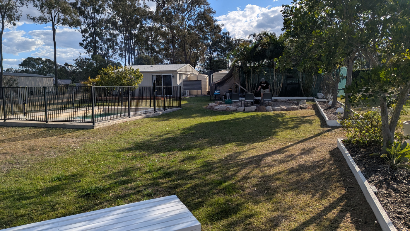
Past the fire pit, the clearest request Jake had was bottle trees. He wanted them in, specifically, as something that would still be standing on the property in decades. I paired two sites for them, one in the working garden and one out at the forest edge, holding a view south toward the range that isn't going anywhere either. A request like that isn't a planting decision so much as a structural one. Everything else in that part of the design got built to sit around it, not the other way.
One planting doing four jobs
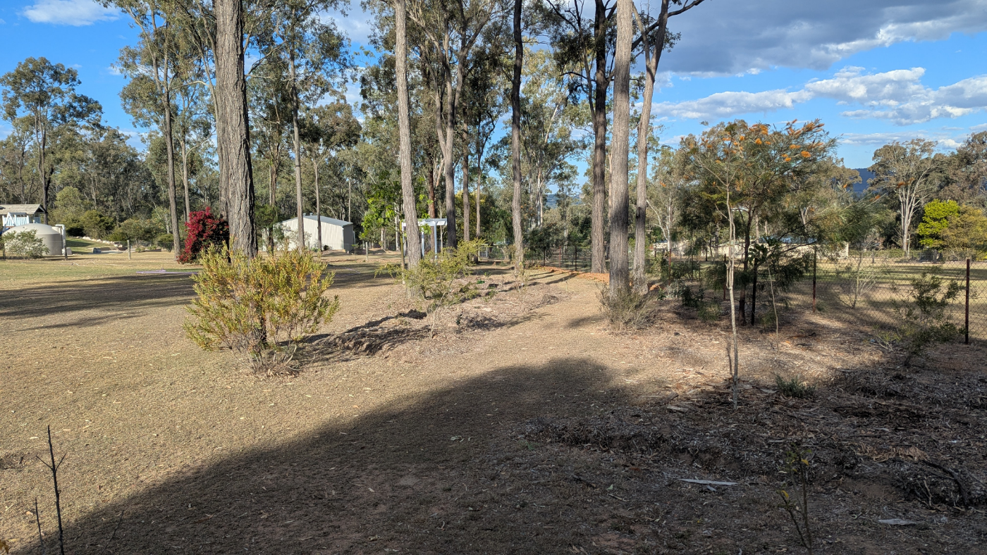
The southern and western boundary had a genuine problem to solve. It needed to slow prevailing wind, it sat on the side the fire risk mapping flagged, and Jake wanted it to shelter a koala refuge, all on the same strip of ground. Those three don't obviously fit together. A dense, tight windbreak is exactly the kind of fuel load you don't want close to a structure in a fire risk zone.
The answer wasn't picking one priority over the others. It was distance: fire-resistant, low-fuel planting close in, denser wildlife habitat further out, with the whole band still reading as one continuous planting rather than three separate zones fighting each other.
That's the property's long-term structure now, doing wind protection, fire safety, and habitat at once, on the one piece of ground.
Getting it wrong, and catching it
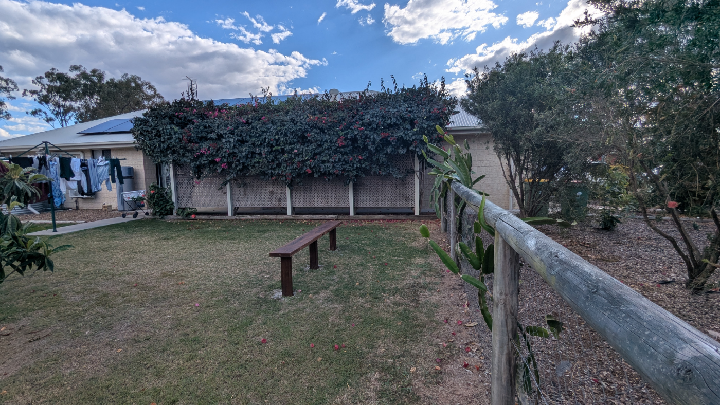
Before any design leaves my hands, I go back through the finished package against everything I actually wrote for that property, line by line. On Jake's project, that check caught something real.
There's an arbour planned for a wedding on the property next year, and I'd written the surrounding planting around a plant that flowers late in winter, on the assumption the wedding would land in the coldest, driest stretch of the year. It doesn't. It's in early autumn. Going back through my own notes against the actual date is what surfaced the mismatch, not a moment of inspiration. I swapped the primary display planting for something that actually flowers in autumn, kept the original plant in as structural greenery instead of the star of the show, and fixed it the same day, before the design went out.
I'd rather tell that straight than pretend every detail lands right the first time. What actually catches a mistake like that isn't talent, it's a habit of checking your own work against the real facts of the property one more time before anyone else sees it.
Building the map, layer by layer
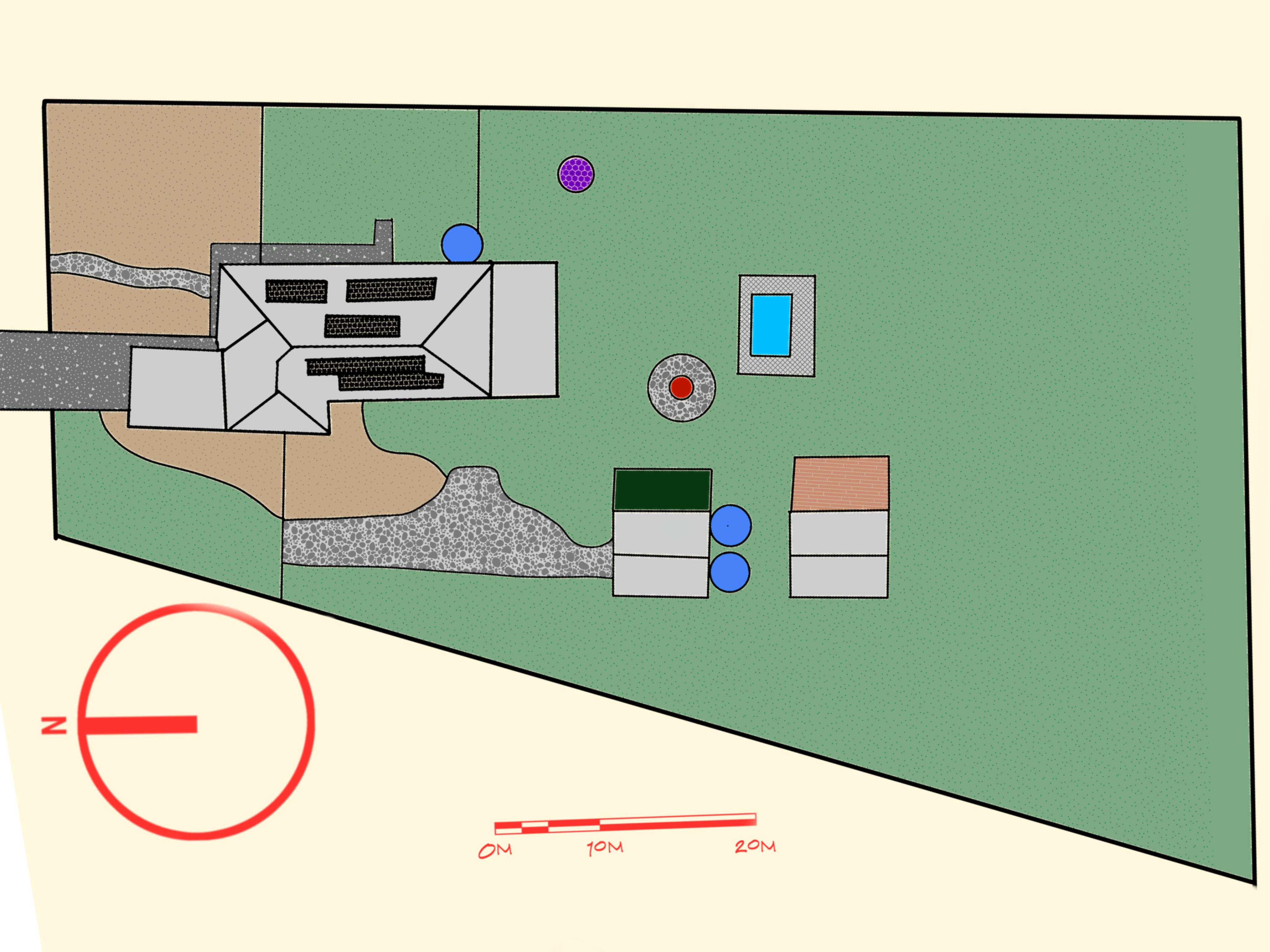
Before any planting goes on the plan, the base map records what's already there: the house, the sheds, the driveway, the fire pit, the existing garden. Everything the design has to work around.
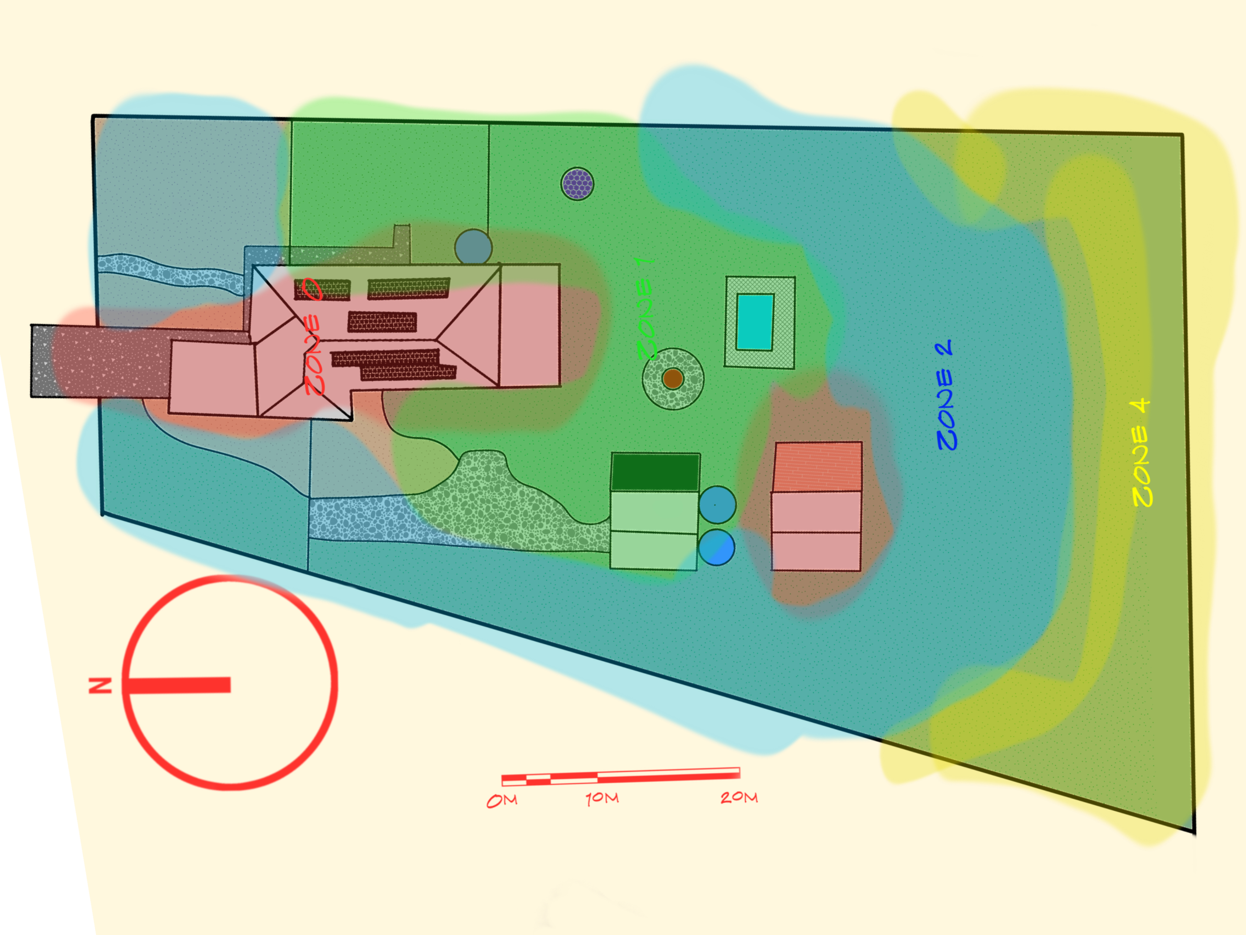
Then the zone map. This decides what goes where based on how often it actually needs your attention. The herbs and salad greens you pick every day go in Zone 1, right outside the door. The fruit tree guilds that need weekly checks sit in Zone 2. The boundary planting that mostly looks after itself sits further out. It's a time map as much as a space map.
What actually came out of it
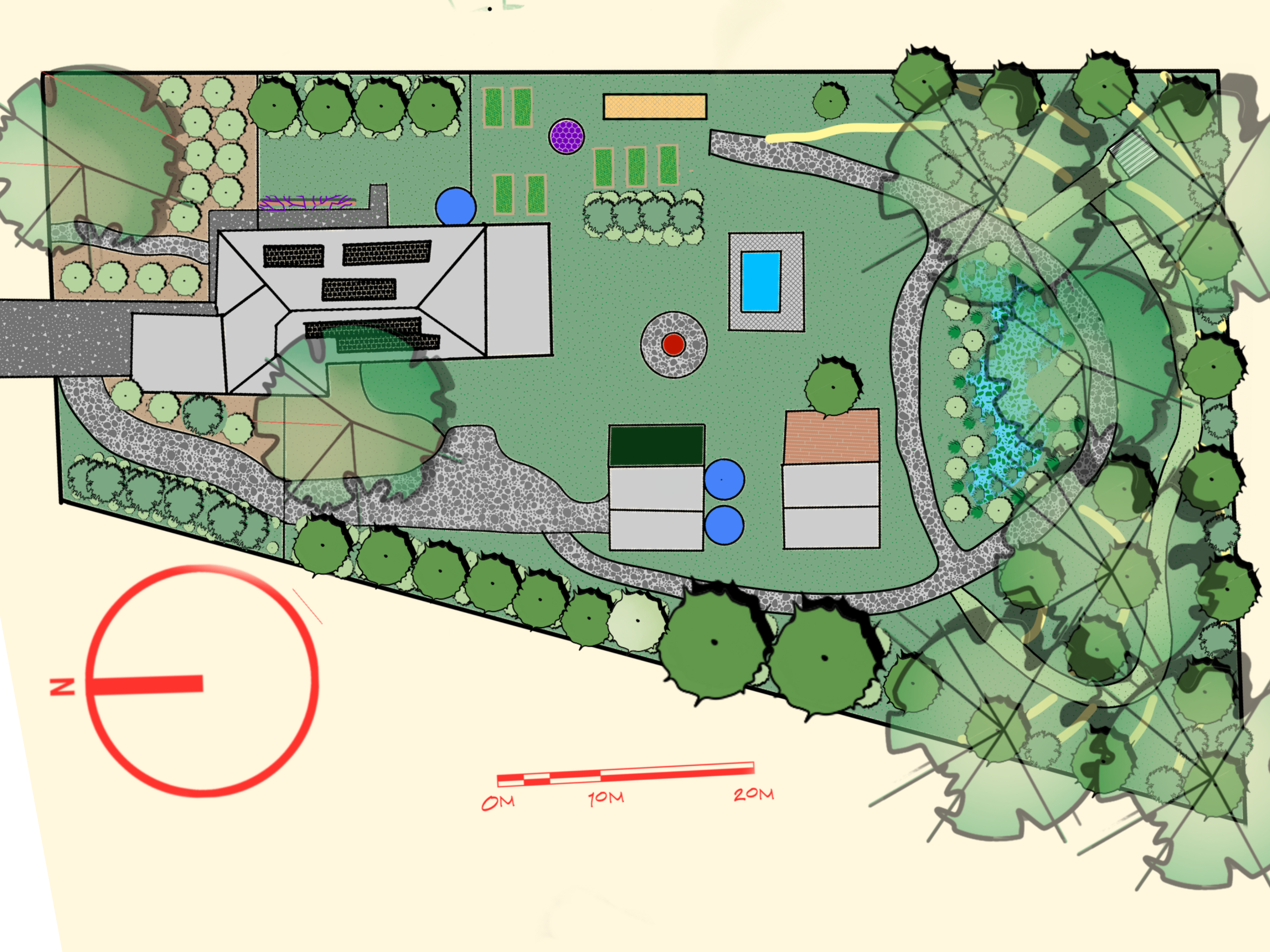
A soil-building program that runs across the whole property, not just the worst corner. A chicken and compost system feeding four fruit tree guilds along the path he already walks every day. Paired bottle trees holding the property's structure for decades. One boundary planting doing four jobs instead of one. A walking track with swales dug along the contour underneath it, catching water instead of losing it downslope. All of it staged, so it gets built over years rather than needing to happen at once.
None of that came from a plan I already had before I turned up. It came from a couple of hours on the ground, three jars of sand, one clear request I built the whole structure around, and one honest check before anything left my hands.